Did you ever want to know where exactly is your location or where is north, for example? Or maybe you were snowed in somewhere and wanted to know exactly where you are? Whether you were ever confronted with the situations mentioned above or you just wanted to know how to get to Euclid Street, this list of the most useful GPS applications for iOS and Android will surely come in handy. From compasses or GPS tests to navigators, these applications will help you make sure you will not get lost in any circumstance.
Smart Compass has an interesting feature that allows you to use the compass overlapping the camera image. You can find the exact location of a tourist attraction, for example, or you can detect metal if you want. For adventurers, the app can be used both in portrait and in landscape, and the needle will always show true or geographical north, depending on the option chosen. The Pro version comes in a small price. This unlocks access to view to geographic north and magnetic sensor and various geographical or military coordinates. If you want, you can send your current position via SMS or e- mail, you can locate the car or you can see the real speed, using GPS.

2. Commander Compass Lite (iOS)
The free version of the Commander Compass app is a must-have for any hiking enthusiast. Commander Compass Lite is a practical compass and a GPS navigator with some smart functions: gyro compass, maps, GPS tracker, altimeter, speedometer, calibration after the sun, moon or stars, and coordinate converter. The paid version unlocks access to a few additional functions.

Although it is free in Google Play, Compass Pro is also one of the most powerful applications for navigation. It’s like a compass made for professionals. You can rotate the dial and you can use azimuth, but you can also display the exact position on the globe. To orient yourself properly, you just have to first put the phone on a flat surface and place the edge of the dial towards the direction of your choice. Then you have to try to keep the degrees shown on the screen. If they change, that means you are going in the wrong direction. The only disadvantage of Compass Pro is the steep learning curve. But if you know how to use a compass for orientation, it’s the perfect application.
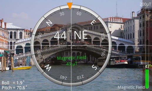
This app combine the function of a compass with map data for navigation and weather data. Compass 54 Pro is one of the top apps in the AppStore and it can show the exact position, direction, altitude, course and speed. Although these functions can be provided by other applications, the weather data makes the difference and it will help you not to get caught on the wrong foot.

GPS Test from Chartcross is one of the most popular free applications for Android. Besides the GPS module test functions, the app allows you to see the exact coordinates, their accuracy, altitude and speed. It show to how many satellites is your phone connected and the quality of the GPS signal. The advantage is that it can show you coordinates with different reference systems. The paid version gives you access to additional features such as navigation or head up car display.
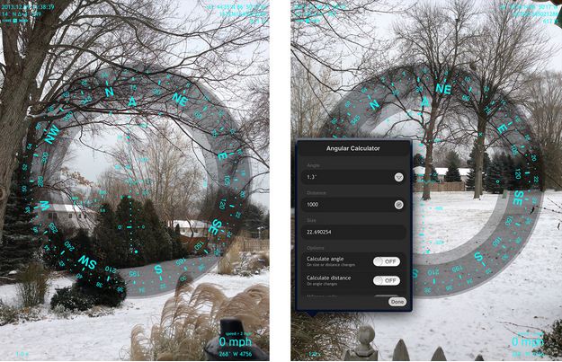
Spyglass is coming straight from the movies with secret agents. It not only tells you where you are heading, direction of travel and degreed, but it uses augmented reality to show you where to head to. The gyro compass used by Spyglass is almost as accurate as those used in aviation or marine. The application has also other functions and uses almost all the sensors on the iPhone. The only downside is the slightly high price.
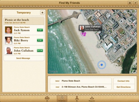
The application is available in the AppStore and allows you to locate your friends or family members. The only condition is that they too have the application installed. It’s easy to add your friends list: choose them from contacts or send them an invitation. Once they install the application and allow you location, you can see where they are. You yourself can reveal your location permanently or temporarily, in the case of an event, for example.

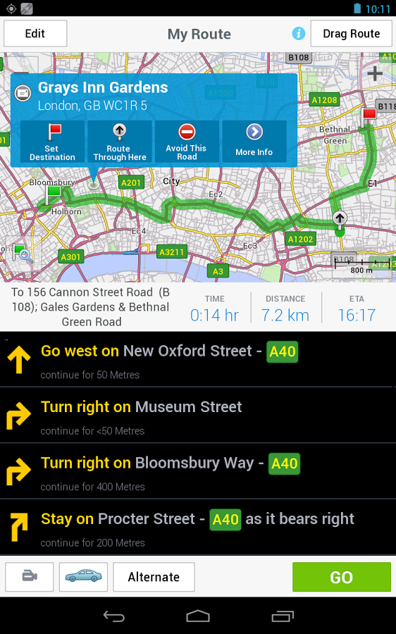
8. Google Maps
Google Maps is by far the most versatile application for both Android and iOS. Since version 7, Google Maps has received a lot of new functions and a new interface. It is almost needless to mention how many things you can do with Google Maps, even in the absence of an Internet connection. This despite the fact that the maps offline option was hidden well by Google. The latest version of Maps covers 200 countries, provides voice guidance navigation for both drivers and pedestrians or bicyclists and transit routes for more than 800 cities, detailed information about traffic incidents and important attractions.
9. CoPilot GPS
This is a free application available for Android or iOS. It proposes navigation tools including maps, a list of main routes and a list of tourist attractions in major cities. The application can be downloaded for purchase as well, offering you more information plus available voice guide, which will provide detailed route guidance, including street names. Also, CoPilot GPS can offer up to three alternative pedestrian routes, auto and standard map of the area.

10. Waze (iPhone / iPad, Android)
Waze works on any Android device, but when it comes to iOS, it is unavailable for iPod Touch. The GPS functions are supplemented by warnings about traffic, aiming both congested areas and work accidents or blockages. In this app, the user enters the destination and the application calculates the route and provides alerts about problem areas.
Leave a Reply